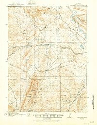
1921 Map of Saddleback Hills
USGS Topo · Published 1951About this map
Saddleback Hills dominate the western portion of this high-plains landscape, where early 20th-century ranching and rail infrastructure meet the headwaters of the Medicine Bow River. The Union Pacific line serves as the primary corridor of movement, passing by the settlement of Carbon and several water sources vital to steam operations and livestock, including Como Lake and Allen Lake. The distribution of named springs such as Missouri John Spring, Hi Allen Spring, and Jacks Spring suggests a reliance on specific water points in a semi-arid environment.
Find a feature on this map
32 named features on this map. Tap any name to fly to it.
Don’t see what you’re looking for? This feature index may not catch every label — zoom into the map to look around manually.
Map Details
Editions of this 1921 Saddleback Hills Map
2 editions found
Other maps of this area

1893 · Fort Steele
USGS Topo · 1:125,000

1914 · Hanna
USGS Topo · 1:62,500

1914 · Saddleback Hills
USGS Topo · 1:62,500

1915 · Como Ridge
USGS Topo · 1:48,000

1918 · Como Ridge
USGS Topo · 1:62,500

1921 · Saddleback Hills
USGS Topo · 1:62,500

1953 · T E Ranch
USGS Topo · 1:24,000

1954 · Rawlins
USGS Topo · 1:250,000

1955 · Elk Mountain
USGS Topo · 1:24,000

1955 · Rattlesnake Pass
USGS Topo · 1:24,000