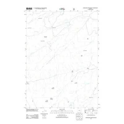
2012 Map of Saddleback Mountain
USGS Topo · Published 2012About this map
Saddleback Mountain dominates this portion of Albany County, where the topography is defined by a succession of high ridges and narrow drainage basins. The landscape is marked by the sawtooth-like profile of North Sawtooth Mountain, Middle Sawtooth Mountain, and South Sawtooth Mountain, which align above the headwaters of Little Bear Cr. Human presence is sparse, centered on seasonal and utility-focused locations such as McDonald Cabin and Morrison Park.
Find a feature on this map
36 named features on this map. Tap any name to fly to it.
Don’t see what you’re looking for? This feature index may not catch every label — zoom into the map to look around manually.
Map Details
Editions of this 2012 Saddleback Mountain Map
This is the sole edition of this map. No revisions or reprints were ever made.
Other maps of this area

1943 · Esterbrook
USGS Topo · 1:62,500

1945 · Esterbrook
USGS Topo · 1:62,500

1949 · Poison Lake
USGS Topo · 1:24,000

1950 · Poison Lake
USGS Topo · 1:24,000

1954 · Torrington
USGS Topo · 1:250,000

1958 · Torrington
USGS Topo · 1:250,000

1964 · Toltec
USGS Topo · 1:24,000

1964 · School Section Mountain
USGS Topo · 1:24,000
1964 · Maneater Creek
USGS Topo · 1:24,000
1964 · Blue Nose Creek
USGS Topo · 1:24,000