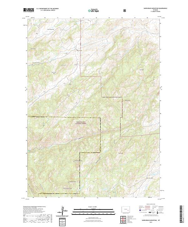
2021 Map of Saddleback Mountain
USGS Topo · Published 2021About this map
The Medicine Bow National Forest dominates this section of the Laramie Range, where the boundary between Converse and Albany counties crosses high-altitude terrain. The geography is defined by prominent peaks including North Sawtooth Mtn, Mid Sawtooth Mtn, and South Sawtooth Mtn, alongside the namesake Saddleback Mtn. This landscape is characterized by a network of drainage systems such as La Bonte Cr and Little Bear Cr, which carve through deep features like West Fork Canyon and Deer Canyon. High meadows and basins like Willox Park and Cummings Park provide distinctive landmarks within the forest. Several established paths, including the Labonte Canyon Trl and Sawtooth Mountain Trl, trace the ridgelines and creek beds, while small water management features like Dunn Reservoir Number 1 indicate localized ranching or conservation use in this high-country environment.
Find a feature on this map
48 named features on this map. Tap any name to fly to it.
Don’t see what you’re looking for? This feature index may not catch every label — zoom into the map to look around manually.
Map Details
Editions of this 2021 Saddleback Mountain Map
This is the sole edition of this map. No revisions or reprints were ever made.
Other maps of this area

1943 · Esterbrook
USGS Topo · 1:62,500

1945 · Esterbrook
USGS Topo · 1:62,500

1949 · Poison Lake
USGS Topo · 1:24,000

1950 · Poison Lake
USGS Topo · 1:24,000

1954 · Torrington
USGS Topo · 1:250,000

1958 · Torrington
USGS Topo · 1:250,000

1964 · Toltec
USGS Topo · 1:24,000

1964 · School Section Mountain
USGS Topo · 1:24,000
1964 · Maneater Creek
USGS Topo · 1:24,000
1964 · Blue Nose Creek
USGS Topo · 1:24,000