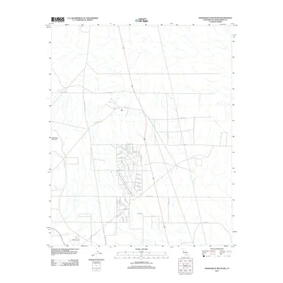
2012 Map of Saddleback Mountain
USGS Topo · Published 2012About this map
Saddleback Mountain stands as the primary topographic landmark in this high desert landscape of San Bernardino County. The area is defined by a rigorous grid of developed and planned roads, suggesting a period of significant suburban or rural residential expansion. Major arteries such as Kramer Station Rd and Rosewood Blvd intersect the terrain, providing access to organized residential clusters centered around Kingston Ave, Winchester Rd, and Springfield Ave. In the southern portion of the quadrangle, the Boron Airstrip indicates the importance of light aviation to this desert region. The map reveals an intricate network of streets including Dorchester Rd and Farmington Rd, illustrating the transition from open scrubland to a surveyed residential community during the early twenty-first century.
Find a feature on this map
38 named features on this map. Tap any name to fly to it.
Don’t see what you’re looking for? This feature index may not catch every label — zoom into the map to look around manually.
Map Details
Editions of this 2012 Saddleback Mountain Map
This is the sole edition of this map. No revisions or reprints were ever made.
Other maps of this area

1915 · Searles Lake
USGS Topo · 1:250,000

1932 · Barstow
USGS Topo · 1:125,000

1934 · Barstow
USGS Topo · 1:125,000

1937 · Kramer
USGS Topo · 1:48,000

1942 · Kramer
USGS Topo · 1:62,500

1947 · Kramer
USGS Topo · 1:24,000

1947 · Johannesburg SE
USGS Topo · 1:25,000

1947 · Rich
USGS Topo · 1:24,000

1947 · Johannesburg SW
USGS Topo · 1:24,000

1947 · Trona
USGS Topo · 1:250,000