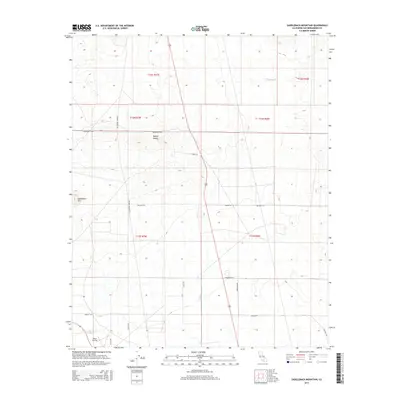
2015 Map of Saddleback Mountain
USGS Topo · Published 2015About this map
Saddleback Mtn dominates the western edge of this arid landscape, standing as a prominent landmark within the Mojave Desert of San Bernardino County. In the southwest corner, the Boron Airstrip reflects the region's aviation and industrial needs, serving as a critical infrastructure point near the massive mining operations just outside the map boundary. The landscape is defined by a rigid grid of desert tracks and thoroughfares, such as Rosewood Blvd, Kramer Station Rd, and Pipeline Rd. These roads suggest a transition between remote desert terrain and the structured development of the nearby Boron community. The presence of numerous township and range boundaries, including t11n r7w and t12n r6w, highlights the administrative partitioning of this wide-open territory, where utility corridors and access roads like Balsamo Rd and Haven Rd crisscross the sagebrush and salt flats.
Find a feature on this map
21 named features on this map. Tap any name to fly to it.
Don’t see what you’re looking for? This feature index may not catch every label — zoom into the map to look around manually.
Map Details
Editions of this 2015 Saddleback Mountain Map
This is the sole edition of this map. No revisions or reprints were ever made.
Other maps of this area

1915 · Searles Lake
USGS Topo · 1:250,000

1932 · Barstow
USGS Topo · 1:125,000

1934 · Barstow
USGS Topo · 1:125,000

1937 · Kramer
USGS Topo · 1:48,000

1942 · Kramer
USGS Topo · 1:62,500

1947 · Kramer
USGS Topo · 1:24,000

1947 · Johannesburg SE
USGS Topo · 1:25,000

1947 · Rich
USGS Topo · 1:24,000

1947 · Johannesburg SW
USGS Topo · 1:24,000

1947 · Trona
USGS Topo · 1:250,000