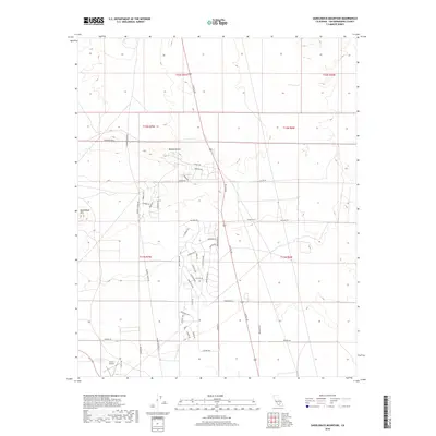
2018 Map of Saddleback Mountain
USGS Topo · Published 2018About this map
Saddleback Mtn rises above the arid expanse of the Mojave Desert in this portion of San Bernardino County. The landscape is defined by a dense grid of residential and arterial roads, many bearing botanical and geographic names, which suggest a planned or subdivided layout across the desert floor. Significant corridors like Kramer Station Rd and Rosewood Blvd anchor the local transit network, while numerous smaller avenues such as Lancaster Ave and Rutledge Ave delineate individual blocks of the settlement area. In the southwest corner, the Boron Airstrip reflects the region's relationship with aviation and open-space utility. The map captures a moment in the 21st century where the desert's natural contours meet a sprawling, structured human footprint, evident in the intersection of naming conventions like Locust Rd and Sheep Creek Rd.
Find a feature on this map
47 named features on this map. Tap any name to fly to it.
Don’t see what you’re looking for? This feature index may not catch every label — zoom into the map to look around manually.
Map Details
Editions of this 2018 Saddleback Mountain Map
This is the sole edition of this map. No revisions or reprints were ever made.
Other maps of this area

1915 · Searles Lake
USGS Topo · 1:250,000

1932 · Barstow
USGS Topo · 1:125,000

1934 · Barstow
USGS Topo · 1:125,000

1937 · Kramer
USGS Topo · 1:48,000

1942 · Kramer
USGS Topo · 1:62,500

1947 · Kramer
USGS Topo · 1:24,000

1947 · Johannesburg SE
USGS Topo · 1:25,000

1947 · Rich
USGS Topo · 1:24,000

1947 · Johannesburg SW
USGS Topo · 1:24,000

1947 · Trona
USGS Topo · 1:250,000