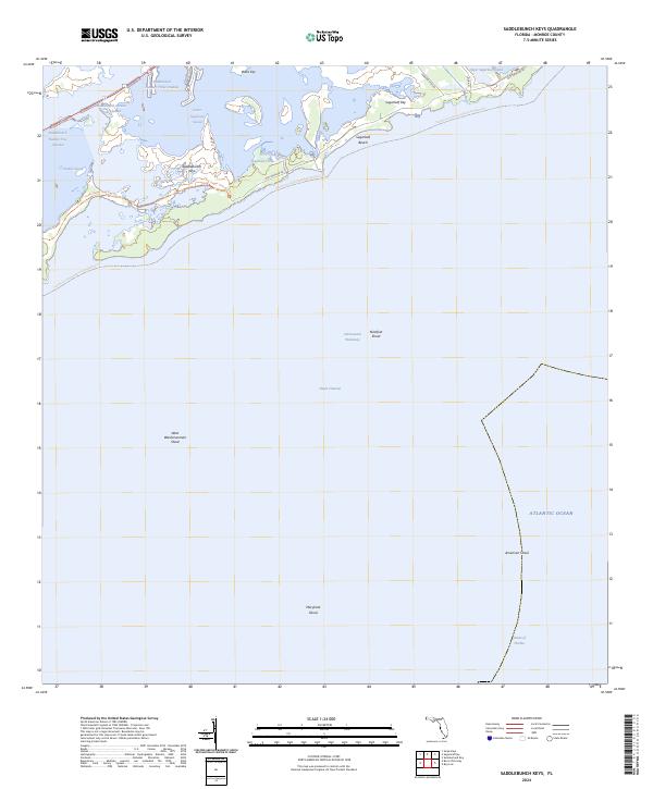
2024 Map of Saddlebunch Keys
USGS Topo · Published 2024About this map
Sugarloaf Key and the Saddlebunch Keys dominate this coastal survey of the Florida Keys, where protected mangroves and shallow tidal channels define the landscape. Much of the northern area is managed as the Great White Heron National Wildlife Refuge, preserving the delicate environment of Wells Key and Similar Sound. The map reveals the intricate network of tidal passages such as Saddlebunch Number Three Channel and Sugarloaf Creek, which connect the interior sounds to the wider Atlantic waters.
Find a feature on this map
28 named features on this map. Tap any name to fly to it.
Don’t see what you’re looking for? This feature index may not catch every label — zoom into the map to look around manually.
Map Details
Editions of this 2024 Saddlebunch Keys Map
This is the sole edition of this map. No revisions or reprints were ever made.
Other maps of this area

1921 · Sugar Loaf Key
USGS Topo · 1:62,500

1943 · Saddlebunch Keys
USGS Topo · 1:24,000

1943 · Boca Chica
USGS Topo · 1:24,000

1943 · Snipe Keys
USGS Topo · 1:24,000

1943 · Sugarloaf Key
USGS Topo · 1:24,000

1968 · Saddlebunch Keys
USGS Topo · 1:24,000
1971 · Boca Chica Key
USGS Topo · 1:24,000

1972 · Loggerhead Key
USGS Topo · 1:24,000

1972 · Snipe Keys
USGS Topo · 1:24,000
1972 · Saddlebunch Keys
USGS Topo · 1:24,000