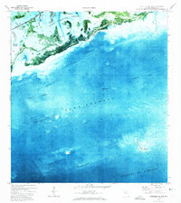
1972 Map of Saddlebunch Keys
USGS Topo · Published 1973About this map
Saddlebunch Keys and the surrounding marine landscape of Monroe County are captured here in the early 1970s, transitioning from the shallow mangrove environments of Lower Sugarloaf Sound to the deep waters of the Straits of Florida. This orthophotomap combines aerial photography with traditional topographic data, revealing the intricate network of natural and dredged channels like Saddlebunch No 3 Chan and Saddlebunch No 4 Channel that define the local maritime navigation.
Find a feature on this map
17 named features on this map. Tap any name to fly to it.
Don’t see what you’re looking for? This feature index may not catch every label — zoom into the map to look around manually.
Map Details
Editions of this 1972 Saddlebunch Keys Map
This is the sole edition of this map. No revisions or reprints were ever made.
Other maps of this area

1921 · Sugar Loaf Key
USGS Topo · 1:62,500

1943 · Saddlebunch Keys
USGS Topo · 1:24,000

1943 · Boca Chica
USGS Topo · 1:24,000

1943 · Snipe Keys
USGS Topo · 1:24,000

1943 · Sugarloaf Key
USGS Topo · 1:24,000

1968 · Saddlebunch Keys
USGS Topo · 1:24,000
1971 · Boca Chica Key
USGS Topo · 1:24,000

1972 · Loggerhead Key
USGS Topo · 1:24,000
1972 · Snipe Keys
USGS Topo · 1:24,000

1972 · Summerland Key
USGS Topo · 1:24,000