
1972 Map of Summerland Key
USGS Topo · Published 1973About this map
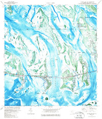
National Key Deer Refuge and the Great White Heron National Wildlife Refuge dominate this 1970s orthophotomap, where the intricate network of the lower Florida Keys is documented with precision. The map shows the expanding human footprint on Summerland Key and Ramrod Key alongside several quarries and a Trailer Park. This era represents a period of significant development in the Keys, captured here through aerial photography and planetable surveys. Complex waterways like Kemp Channel, Niles Channel, and the Torch Ramrod Channel wind between small islands such as Toptree Hammock Key and Knockemdown Key. The map also details essential infrastructure of the time, including a Radio Tower, a Boat Ramp, and a Sewage Disposal site on the edge of Cudjoe Bay, providing a clear record of the region's mid-century utility and settlement patterns.
Find a feature on this map
37 named features on this map. Tap any name to fly to it.
Don’t see what you’re looking for? This feature index may not catch every label — zoom into the map to look around manually.
Map Details
Editions of this 1972 Summerland Key Map
2 editions found
Other maps of this area

1921 · Sugar Loaf Key
USGS Topo · 1:62,500

1943 · Saddlebunch Keys
USGS Topo · 1:24,000

1943 · Sugarloaf Key
USGS Topo · 1:24,000

1968 · Saddlebunch Keys
USGS Topo · 1:24,000

1972 · Big Pine Key
USGS Topo · 1:24,000

1972 · Loggerhead Key
USGS Topo · 1:24,000
1972 · Sawyer Key
USGS Topo · 1:24,000

1972 · Horseshoe Keys
USGS Topo · 1:24,000

1972 · Content Keys
USGS Topo · 1:24,000
1972 · Saddlebunch Keys
USGS Topo · 1:24,000