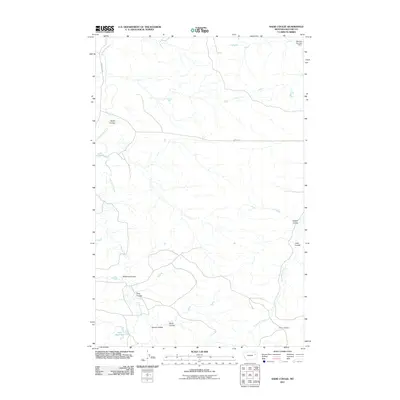
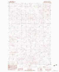
2011 Map of Sadie Coulee
USGS Topo · Published 2011About this map
Prairie Elk Creek meanders through this portion of McCone County, Montana, carving a complex network of dry washes and stream beds characteristic of the northern plains. This 2011 survey illustrates the subtle drainage patterns that define the local topography, with numerous named coulees like Williams Coulee, Sadie Coulee, and Rosie Coulee branching away from the primary watercourses. The landscape is marked by land management and early settlement history, evidenced by the Ervine Cemetery located in the southeast near Porcupine Creek. Ranching and water conservation features are scattered throughout the quadrangle, including Gass Reservoir and the Wendell Number 1 Dam. Local transportation is limited to rural routes such as Prairie Elk Rd and Bass Rd, which provide access to this sparsely populated region where the terrain dictates the flow of travel and land use.
Find a feature on this map
15 named features on this map. Tap any name to fly to it.
Don’t see what you’re looking for? This feature index may not catch every label — zoom into the map to look around manually.
Map Details
Editions of this 2011 Sadie Coulee Map
This is the sole edition of this map. No revisions or reprints were ever made.
Other maps of this area

1954 · Glendive
USGS Topo · 1:250,000

1957 · Glendive
USGS Topo · 1:250,000

1958 · Glendive
USGS Topo · 1:250,000
1983 · Figure Eight Creek
USGS Topo · 1:24,000
1983 · Turtle Creek
USGS Topo · 1:24,000

1983 · Pedigo Coulee
USGS Topo · 1:24,000

1983 · Dailey Spring
USGS Topo · 1:24,000

1983 · Hudiburgh Reservoir NW
USGS Topo · 1:24,000
1983 · Sadie Coulee
USGS Topo · 1:24,000
1983 · Shade Creek
USGS Topo · 1:24,000