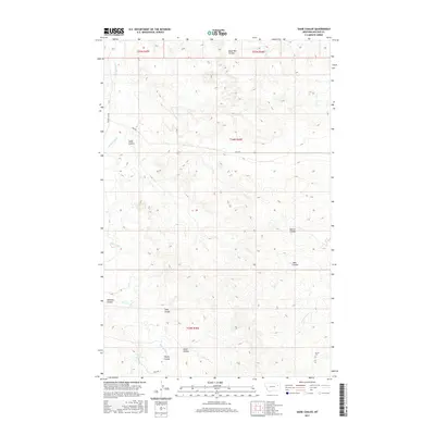
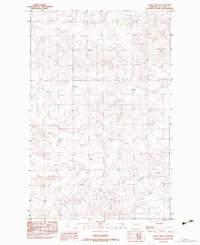
2017 Map of Sadie Coulee
USGS Topo · Published 2017About this map
Sadie Coulee and its neighboring draws define the drainage patterns of this McCone County landscape, where the Missouri River plateau is deeply carved by intermittent watercourses. The presence of Ervine Cem in the southeast corner provides a fixed point for genealogical research, marking the location of early ranching-era burials. A sparse network of gravel routes, including Prairie Elk Rd and Pass Rd, connects the scattered homesteads and pastures. Water management is critical in this arid environment, evidenced by the Gass Reservoir located near the confluence of Young Coulee and Prairie Elk Cr. The map names numerous small features like Dead Man Coulee and John Coulee, which serve as essential landmarks for navigation across the open rangeland.
Find a feature on this map
19 named features on this map. Tap any name to fly to it.
Don’t see what you’re looking for? This feature index may not catch every label — zoom into the map to look around manually.
Map Details
Editions of this 2017 Sadie Coulee Map
This is the sole edition of this map. No revisions or reprints were ever made.
Other maps of this area

1954 · Glendive
USGS Topo · 1:250,000

1957 · Glendive
USGS Topo · 1:250,000

1958 · Glendive
USGS Topo · 1:250,000
1983 · Figure Eight Creek
USGS Topo · 1:24,000
1983 · Turtle Creek
USGS Topo · 1:24,000

1983 · Pedigo Coulee
USGS Topo · 1:24,000

1983 · Dailey Spring
USGS Topo · 1:24,000

1983 · Hudiburgh Reservoir NW
USGS Topo · 1:24,000
1983 · Sadie Coulee
USGS Topo · 1:24,000
1983 · Shade Creek
USGS Topo · 1:24,000