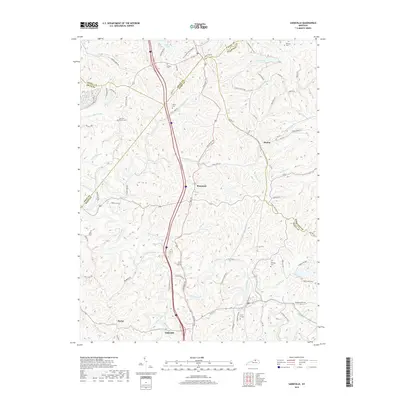
2019 Map of Sadieville
USGS Topo · Published 2019About this map
Sadieville anchors this survey of northern Scott County, where the Interstate 75 corridor bisects a landscape defined by the deep incisions of Eagle Creek and its many tributaries. The area maintains a rural character dominated by family names and community landmarks such as Stonewall, Hinton, and Porter. Local history and genealogy researchers will find several small burial grounds mapped among the ridges, including Ecklers Cem and Nelson Cem near the Grant County line, as well as the Zion Hill Church and its associated Zion Hill Cem. The drainage pattern is complex, with Rays Fork and Little Eagle Creek carving through the terrain. To the north, Corinth Lake and Arrowhead Lake provide significant water features in a region otherwise characterized by winding narrow roads like Cincinnati Rd and Hinton Sadieville Rd.
Find a feature on this map
77 named features on this map. Tap any name to fly to it.
Don’t see what you’re looking for? This feature index may not catch every label — zoom into the map to look around manually.
Map Details
Editions of this 2019 Sadieville Map
This is the sole edition of this map. No revisions or reprints were ever made.
Other maps of this area

1929 · Cynthiana
USGS Topo · 1:48,000

1930 · Falmouth
USGS Topo · 1:48,000

1934 · Cynthiana
USGS Topo · 1:62,500

1936 · Falmouth
USGS Topo · 1:62,500

1939 · Sadieville
USGS Topo · 1:62,500

1950 · Mason
USGS Topo · 1:24,000

1950 · Lawrenceville
USGS Topo · 1:24,000

1953 · Sadieville
USGS Topo · 1:24,000

1953 · Berry
USGS Topo · 1:24,000

1953 · Breckinridge
USGS Topo · 1:24,000