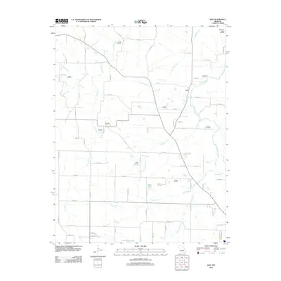
2012 Map of Safe
USGS Topo · Published 2012About this map
Northern Ozark Border terrain defines this region, where the Bourbeuse River and its many tributaries, including Coppedge Creek and Lanes Fork, carve through the landscape. The small settlements of Safe, Highgrove, and Light serve as local anchors in an area characterized by a dense network of county roads. One of the most striking aspects of this map is the high concentration of family and community burial grounds, such as Rock Spring Cemetery, Underwood Cemetery, and Barnwell Cemetery, reflecting generations of local history and kinship in Phelps County. Several small bodies of water, including Amos Lake and Little Prairie Lake, are scattered among the ridges and creek valleys, while Vernon Dillon Lake sits further north near the drainage of Pin Oak Branch.
Find a feature on this map
81 named features on this map. Tap any name to fly to it.
Don’t see what you’re looking for? This feature index may not catch every label — zoom into the map to look around manually.
Map Details
Editions of this 2012 Safe Map
This is the sole edition of this map. No revisions or reprints were ever made.
Other maps of this area

1912 · Rolla
USGS Topo · 1:62,500

1928 · Meramec Spring
USGS Topo · 1:62,500

1934 · Redbird
USGS Topo · 1:62,500

1937 · Vienna
USGS Topo · 1:62,500

1938 · Redbird
USGS Topo · 1:62,500

1938 · Vienna
USGS Topo · 1:48,000

1949 · Saint Louis
USGS Topo · 1:250,000

1949 · Vienna
USGS Topo · 1:62,500

1949 · Rolla
USGS Topo · 1:250,000

1949 · Meramec Spring
USGS Topo · 1:62,500