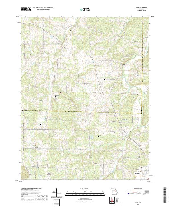
2021 Map of Safe
USGS Topo · Published 2021About this map
The Bourbeuse River carves a winding path through this portion of the Ozark Plateau, where the boundary between Maries and Phelps Counties divides a landscape defined by small-scale agriculture and deep-rooted family homesteads. The small settlement of Safe serves as a central point in a territory heavily marked by its genealogical sites, including the Broadway Baptist Church Cemetery and numerous private burial grounds such as Dillon Cemetery and Sewell Cemetery. These locations, often situated on high ground overlooking tributaries like Lanes Fork or Coppedge Creek, point to the generations of families who have worked this land. Toward the southern edge, the map captures the northern outskirts of St. James, where the terrain begins to transition from the rural river bottoms toward the more developed crossroads of the region.
Find a feature on this map
89 named features on this map. Tap any name to fly to it.
Don’t see what you’re looking for? This feature index may not catch every label — zoom into the map to look around manually.
Map Details
Editions of this 2021 Safe Map
This is the sole edition of this map. No revisions or reprints were ever made.
Other maps of this area

1912 · Rolla
USGS Topo · 1:62,500

1928 · Meramec Spring
USGS Topo · 1:62,500

1934 · Redbird
USGS Topo · 1:62,500

1937 · Vienna
USGS Topo · 1:62,500

1938 · Redbird
USGS Topo · 1:62,500

1938 · Vienna
USGS Topo · 1:48,000

1949 · Saint Louis
USGS Topo · 1:250,000

1949 · Vienna
USGS Topo · 1:62,500

1949 · Rolla
USGS Topo · 1:250,000

1949 · Meramec Spring
USGS Topo · 1:62,500