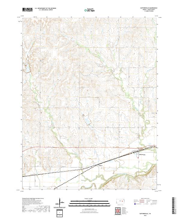
2022 Map of Saffordville
USGS Topo · Published 2022About this map
The Cottonwood River floodplain dominates the southern reaches of this landscape, where the settlements of Saffordville and Ellinor are positioned along the primary transportation corridors. This area of Chase County reflects a classic Kansas section-line road grid, with numerous local routes such as 250 Rd and Z Rd providing access to the interior rangeland and creek bottoms. The northern portion of the map is defined by the drainage systems of Buckeye Cr and Peyton Cr, which cut through the undulating terrain toward the river valley below.
Find a feature on this map
38 named features on this map. Tap any name to fly to it.
Don’t see what you’re looking for? This feature index may not catch every label — zoom into the map to look around manually.
Map Details
Editions of this 2022 Saffordville Map
This is the sole edition of this map. No revisions or reprints were ever made.
Other maps of this area

1885 · Eskridge
USGS Topo · 1:125,000

1888 · Emporia
USGS Topo · 1:125,000

1889 · Parkerville
USGS Topo · 1:125,000

1889 · Eskridge
USGS Topo · 1:125,000

1894 · Emporia
USGS Topo · 1:125,000

1894 · Eskridge
USGS Topo · 1:125,000

1894 · Parkerville
USGS Topo · 1:125,000

1898 · Cottonwood Falls
USGS Topo · 1:125,000

1955 · Hutchinson
USGS Topo · 1:250,000

1957 · Strong City
USGS Topo · 1:24,000