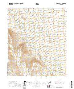
2017 Map of Sagavanirktok A-5 SW
USGS Topo · Published 2017About this map
The Kuparuk River winds across this Arctic landscape, defining the topography of a remote section of Alaska's North Slope. This 2017 survey documents the river's path as it meanders through the expansive North Slope Borough, illustrating the braided drainage patterns and subtle elevation shifts characteristic of the region. While the territory remains largely undeveloped, the map provides precise section and township lines, including t4s r9e, t4s r10e, t5s r9e, and t5s r10e, which are essential for understanding land divisions and resource management in this Arctic environment. Researchers and cartographers can trace the intricate hydrology of the Kuparuk River and its various tributaries as they navigate the low-lying terrain of the far north.
Find a feature on this map
5 named features on this map. Tap any name to fly to it.
Don’t see what you’re looking for? This feature index may not catch every label — zoom into the map to look around manually.
Map Details
Editions of this 2017 Sagavanirktok A-5 SW Map
This is the sole edition of this map. No revisions or reprints were ever made.
Other maps of this area

1951 · Sagavanirktok D-5
USGS Topo · 1:250,000

1951 · Chandler Lake
USGS Topo · 1:250,000

1951 · Brooks
USGS Topo · 1:250,000

1952 · Umiat
USGS Topo · 1:250,000

1956 · Philip Smith Mountains
USGS Topo · 1:250,000

1956 · Chandler Lake
USGS Topo · 1:250,000

1956 · Sagavanirktok
USGS Topo · 1:250,000

1956 · Umiat
USGS Topo · 1:250,000

1958 · Sagavanirktok
USGS Topo · 1:250,000

1964 · Philip Smith Mountains
USGS Topo · 1:250,000