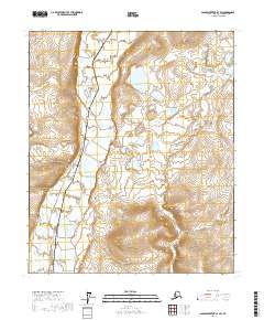
2017 Map of Sagavanirktok B-3 SW
USGS Topo · Published 2017About this map
The braided channels of the Sagavanirktok River dominate this portion of the North Slope, illustrating a vast arctic fluvial system during the early 21st century. Running parallel to the river's western bank, the Alaska Pipeline represents the critical energy infrastructure that redefined this remote region in the latter half of the 20th century. The settlement of Sagwon appears as a key reference point on the eastern side of the river, situated in an area where the terrain begins to transition from the river plain into higher elevations. Significant wetlands and numerous small thaw lakes characterize the landscape, particularly near the confluence of Baluk Creek. The map provides a detailed view of the industrial and environmental intersections in the Alaskan interior, documenting the specific corridor used for resource transport across the tundra.
Find a feature on this map
8 named features on this map. Tap any name to fly to it.
Don’t see what you’re looking for? This feature index may not catch every label — zoom into the map to look around manually.
Map Details
Editions of this 2017 Sagavanirktok B-3 SW Map
This is the sole edition of this map. No revisions or reprints were ever made.
Other maps of this area

1951 · Sagavanirktok D-5
USGS Topo · 1:250,000

1956 · Sagavanirktok
USGS Topo · 1:250,000

1958 · Sagavanirktok
USGS Topo · 1:250,000

1964 · Sagavanirktok
USGS Topo · 1:250,000
1971 · Sagavanirktok B-4
USGS Topo · 1:63,360
1971 · Sagavanirktok B-3
USGS Topo · 1:63,360
1971 · Sagavanirktok A-3
USGS Topo · 1:63,360
1971 · Sagavanirktok A-4
USGS Topo · 1:63,360
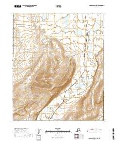
2017 · Sagavanirktok B-3 NW
USGS Topo · 1:25,000
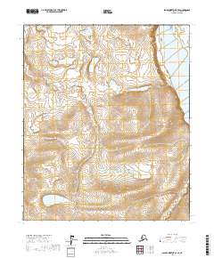
2017 · Sagavanirktok B-3 SE
USGS Topo · 1:25,000