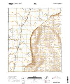
2017 Map of Sagavanirktok D-3 NW
USGS Topo · Published 2017About this map
The Sagavanirktok River dominates this Arctic landscape as it meanders through a network of wetlands and braided channels. This 2017 survey captures the industrial footprint of the Alaska Pipeline, which runs north-to-south through the western portion of the quadrangle. The map illustrates the specialized infrastructure required to navigate the North Slope, where the pipeline serves as a singular human-made landmark across miles of natural drainage patterns and topographical relief. This area is defined by the intersection of vital energy transport and the complex hydrology of the Sagavanirktok basin, providing a clear view of how large-scale engineering integrates with the environment in this part of Alaska.
Find a feature on this map
10 named features on this map. Tap any name to fly to it.
Don’t see what you’re looking for? This feature index may not catch every label — zoom into the map to look around manually.
Map Details
Editions of this 2017 Sagavanirktok D-3 NW Map
This is the sole edition of this map. No revisions or reprints were ever made.
Other maps of this area

1951 · Beechey Point
USGS Topo · 1:250,000

1951 · Sagavanirktok D-5
USGS Topo · 1:250,000

1955 · Beechey Point
USGS Topo · 1:250,000

1955 · Beechey Point A-3
USGS Topo · 1:63,360

1955 · Beechey Point A-4
USGS Topo · 1:63,360

1955 · Sagavanirktok D-3
USGS Topo · 1:63,360

1955 · Sagavanirktok D-4
USGS Topo · 1:63,360

1956 · Sagavanirktok
USGS Topo · 1:250,000

1958 · Sagavanirktok
USGS Topo · 1:250,000

1960 · Beechey Point
USGS Topo · 1:250,000