
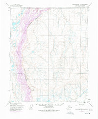
1955 Map of Sagavanirktok D-3
USGS Topo · Published 1970About this map
Sagavanirktok River dominates the western portion of this Arctic landscape, its braided channels weaving a complex hydrological pattern across the North Slope. These intricate waterways contrast sharply with the prominent elevation of the Franklin Bluffs, which rise to the east. Compiled from 1955 aerial photography by the Army Map Service, the map documents a vast, unpopulated wilderness before the era of intensive resource development. The survey reveals the natural geological and hydrological state of the region, where numerous unnamed lakes and seasonal streams punctuate the terrain. The lack of roads or established settlements emphasizes the isolation of this tundra environment during the mid-twentieth century, providing a baseline for environmental and geographic study of the Alaskan North.
Find a feature on this map
2 named features on this map. Tap any name to fly to it.
Don’t see what you’re looking for? This feature index may not catch every label — zoom into the map to look around manually.
Map Details
Editions of this 1955 Sagavanirktok D-3 Map
2 editions found
Other maps of this area

1951 · Beechey Point
USGS Topo · 1:250,000

1951 · Sagavanirktok D-5
USGS Topo · 1:250,000

1955 · Beechey Point
USGS Topo · 1:250,000

1955 · Beechey Point A-2
USGS Topo · 1:63,360

1955 · Beechey Point A-3
USGS Topo · 1:63,360

1955 · Beechey Point A-4
USGS Topo · 1:63,360
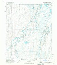
1955 · Sagavanirktok D-2
USGS Topo · 1:63,360

1955 · Sagavanirktok D-4
USGS Topo · 1:63,360

1956 · Sagavanirktok
USGS Topo · 1:250,000

1958 · Sagavanirktok
USGS Topo · 1:250,000