
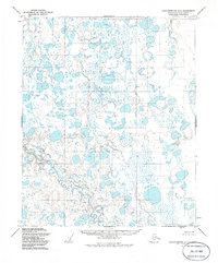
1955 Map of Sagavanirktok D-4
USGS Topo · Published 1970About this map
The Toolik River and Putuligayuk River dominate this 1955 topographic survey of the North Slope, revealing a landscape of intricate hydrological patterns before the era of intensive petroleum development. The terrain is characterized by a dense network of thaw lakes and braided river channels, with specific elevation points or topographical markers noted by distinct names such as Whiskey, Livid, and Skimp. Near the southern reach of the rivers, a landmark labeled Beny provides a point of reference in an otherwise fluid environment. This document, produced from aerial photography by the Army Map Service, captures the pristine state of the Alaskan arctic coastal plain, where the lack of roads or permanent settlements highlights the isolation of these watersheds in the mid-20th century.
Find a feature on this map
6 named features on this map. Tap any name to fly to it.
Don’t see what you’re looking for? This feature index may not catch every label — zoom into the map to look around manually.
Map Details
Editions of this 1955 Sagavanirktok D-4 Map
2 editions found
Other maps of this area

1951 · Beechey Point
USGS Topo · 1:250,000

1951 · Sagavanirktok D-5
USGS Topo · 1:250,000

1955 · Beechey Point
USGS Topo · 1:250,000

1955 · Beechey Point A-5
USGS Topo · 1:63,360

1955 · Beechey Point A-3
USGS Topo · 1:63,360

1955 · Beechey Point A-4
USGS Topo · 1:63,360

1955 · Sagavanirktok D-3
USGS Topo · 1:63,360
1955 · Sagavanirktok D-5
USGS Topo · 1:63,360

1956 · Sagavanirktok
USGS Topo · 1:250,000

1958 · Sagavanirktok
USGS Topo · 1:250,000