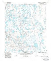
1955 Map of Sagavanirktok D-4
USGS Topo · Published 1986About this map
The Toolik River winds through this expanse of the North Slope, where the landscape is defined by a dense network of thaw lakes and wetlands captured in 1955. This topographic study, based on aerial photography from the mid-century, reveals a territory devoid of permanent roads or trails, illustrating the remote character of the North Slope Borough prior to extensive industrial development. Small, isolated topographic points such as Skimo, Whitley, Livid, and Ben serve as the only named landmarks across the tundra. The Putuligayuk River appears in the northeast, marking the drainage patterns of this flat, water-dominated terrain. The map provides a detailed view of the unsurveyed and unmarked land lines as predetermined by the Bureau of Land Management, reflecting the early administrative efforts to map this northern frontier.
Find a feature on this map
6 named features on this map. Tap any name to fly to it.
Don’t see what you’re looking for? This feature index may not catch every label — zoom into the map to look around manually.
Map Details
Editions of this 1955 Sagavanirktok D-4 Map
2 editions found
Other maps of this area

1951 · Beechey Point
USGS Topo · 1:250,000

1951 · Sagavanirktok D-5
USGS Topo · 1:250,000

1955 · Beechey Point
USGS Topo · 1:250,000

1955 · Beechey Point A-5
USGS Topo · 1:63,360

1955 · Beechey Point A-3
USGS Topo · 1:63,360

1955 · Beechey Point A-4
USGS Topo · 1:63,360

1955 · Sagavanirktok D-3
USGS Topo · 1:63,360
1955 · Sagavanirktok D-5
USGS Topo · 1:63,360

1955 · Sagavanirktok D-4
USGS Topo · 1:63,360

1956 · Sagavanirktok
USGS Topo · 1:250,000