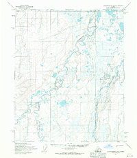
1955 Map of Sagavanirktok D-2
USGS Topo · Published 1970About this map
Kadleroshilik River meanders across this Arctic landscape, its braided channels and complex oxbows dominating the western half of the territory. This 1955 survey, compiled from aerial photographs by the Army Map Service, documents a vast, marshy plain defined by countless small ponds and thermokarst lakes. To the east, the Shaviovik River flows northward toward the Beaufort Sea, while the presence of a Winter Trail provides a singular trace of human passage through this environment. The map reflects a moment in the mid-1950s when the region remained largely unsurveyed on the ground, with land lines representing predetermined but unmarked locations according to the Bureau of Land Management.
Find a feature on this map
3 named features on this map. Tap any name to fly to it.
Don’t see what you’re looking for? This feature index may not catch every label — zoom into the map to look around manually.
Map Details
Editions of this 1955 Sagavanirktok D-2 Map
This is the sole edition of this map. No revisions or reprints were ever made.
Other maps of this area

1951 · Beechey Point
USGS Topo · 1:250,000

1951 · Sagavanirktok D-5
USGS Topo · 1:250,000

1955 · Beechey Point
USGS Topo · 1:250,000

1955 · Beechey Point A-1
USGS Topo · 1:63,360

1955 · Beechey Point A-2
USGS Topo · 1:63,360

1955 · Beechey Point A-3
USGS Topo · 1:63,360

1955 · Sagavanirktok D-3
USGS Topo · 1:63,360
1955 · Sagavanirktok C-1
USGS Topo · 1:63,360
1955 · Sagavanirktok D-1
USGS Topo · 1:63,360

1956 · Sagavanirktok
USGS Topo · 1:250,000