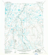
1955 Map of Sagavanirktok D-1
USGS Topo · Published 1970About this map
The Kavik River and Shaviovik River carve through this remote stretch of Alaska's North Slope, displaying the intricate braided patterns and numerous oxbow lakes characteristic of Arctic coastal plain drainages. This 1955 survey by the Army Map Service reveals a landscape defined by water and permafrost, where the terrain is almost entirely devoid of permanent structures. A notable human element is the Winter Trail cutting across the northwestern quadrant, tracing a path through the marshy lowland between the river systems. The map provides a look at the region's topography before significant industrial development, when land lines were still largely unsurveyed and unmarked as predetermined by the Bureau of Land Management. The shifting river channels and seasonal routes documented here offer essential data for understanding the historical geography of this section of the Sagavanirktok Quadrangle.
Find a feature on this map
3 named features on this map. Tap any name to fly to it.
Don’t see what you’re looking for? This feature index may not catch every label — zoom into the map to look around manually.
Map Details
Editions of this 1955 Sagavanirktok D-1 Map
This is the sole edition of this map. No revisions or reprints were ever made.
Other maps of this area

1951 · Beechey Point
USGS Topo · 1:250,000

1951 · Sagavanirktok D-5
USGS Topo · 1:250,000

1951 · Mt. Michelson
USGS Topo · 1:250,000

1955 · Flaxman Island
USGS Topo · 1:250,000

1955 · Beechey Point
USGS Topo · 1:250,000

1955 · Mount Michelson C-5
USGS Topo · 1:63,360

1955 · Mount Michelson D-5
USGS Topo · 1:63,360

1955 · Flaxman Island A-5
USGS Topo · 1:63,360

1955 · Beechey Point A-1
USGS Topo · 1:63,360

1955 · Beechey Point A-2
USGS Topo · 1:63,360