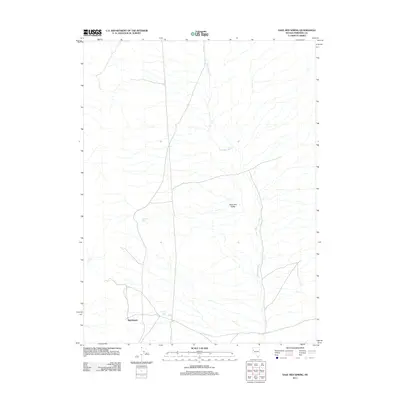
2011 Map of Sage Hen Spring
USGS Topo · Published 2011About this map
Nightingale occupies a small corner of this arid landscape in Pershing County, situated near the western edge of the valley floor. The settlement is positioned along a network of local roads that navigate the vast alluvial fans and dry watercourses typical of the high desert. Water management is a central theme of this terrain, anchored by Sage Hen Spring and the nearby Lintons Well, which serve as vital points in an otherwise thirsty environment. The expansive Sage Hen Valley is the dominant topographic feature, defined by the intricate drainage patterns of the Sage Hen Wash. This 2011 survey reflects the enduring character of Nevada’s interior, where isolated springs and wells continue to dictate the placement of human activity and transportation routes across the open range.
Find a feature on this map
5 named features on this map. Tap any name to fly to it.
Don’t see what you’re looking for? This feature index may not catch every label — zoom into the map to look around manually.
Map Details
Editions of this 2011 Sage Hen Spring Map
This is the sole edition of this map. No revisions or reprints were ever made.
Other maps of this area

1886 · Granite Range
USGS Topo · 1:250,000

1890 · Wadsworth
USGS Topo · 1:125,000

1892 · Wadsworth
USGS Topo · 1:125,000

1894 · Granite Range
USGS Topo · 1:250,000

1894 · Wadsworth
USGS Topo · 1:125,000

1955 · Lovelock
USGS Topo · 1:250,000

1957 · Fireball Ridge
USGS Topo · 1:62,500

1957 · Nixon
USGS Topo · 1:62,500

1957 · Reno
USGS Topo · 1:250,000

1959 · Lovelock
USGS Topo · 1:250,000