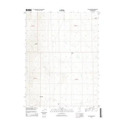
2015 Map of Sage Hen Spring
USGS Topo · Published 2015About this map
Nightingale sits at the southwestern edge of this arid Nevada landscape, where the high desert terrain transitions between prominent mountain ranges. The map reveals the dramatic topography of the Nightingale Mountains and the Sahwave Mountains, separated by the broad drainage of the Sage Hen Valley. This 2015 survey captures a region defined by its sparse water sources, most notably at Sage Hen Spring, which serves as a critical landmark in this remote corner of Pershing County.
Find a feature on this map
11 named features on this map. Tap any name to fly to it.
Don’t see what you’re looking for? This feature index may not catch every label — zoom into the map to look around manually.
Map Details
Editions of this 2015 Sage Hen Spring Map
This is the sole edition of this map. No revisions or reprints were ever made.
Other maps of this area

1886 · Granite Range
USGS Topo · 1:250,000

1890 · Wadsworth
USGS Topo · 1:125,000

1892 · Wadsworth
USGS Topo · 1:125,000

1894 · Granite Range
USGS Topo · 1:250,000

1894 · Wadsworth
USGS Topo · 1:125,000

1955 · Lovelock
USGS Topo · 1:250,000

1957 · Fireball Ridge
USGS Topo · 1:62,500

1957 · Nixon
USGS Topo · 1:62,500

1957 · Reno
USGS Topo · 1:250,000

1959 · Lovelock
USGS Topo · 1:250,000