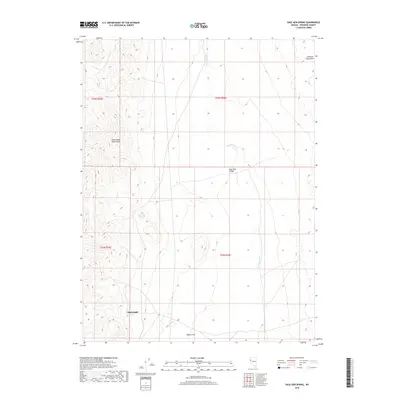
2018 Map of Sage Hen Spring
USGS Topo · Published 2018About this map
Nightingale anchors the southwestern corner of this Pershing County landscape, positioned at the edge of the Nightingale Mountains. The terrain is defined by dramatic elevation changes, rising from the Sage Hen Valley toward the peaks of the Sahwave Mountains to the northeast. This 2018 survey highlights the critical water sources that dictate movement and habitation in this arid environment, specifically the eponymous Sage Hen Spring and the drainage network of Sage Hen Wash. The distribution of these features reveals a geography where human activity, centered on the settlement at Nightingale, remains tied to the narrow corridors between the high desert ranges and the alluvial basins. Southward, the topography terminates at the prominent Nache Peak, providing a clear view of the structural orientation of the Nevada basin and range system.
Find a feature on this map
12 named features on this map. Tap any name to fly to it.
Don’t see what you’re looking for? This feature index may not catch every label — zoom into the map to look around manually.
Map Details
Editions of this 2018 Sage Hen Spring Map
This is the sole edition of this map. No revisions or reprints were ever made.
Other maps of this area

1886 · Granite Range
USGS Topo · 1:250,000

1890 · Wadsworth
USGS Topo · 1:125,000

1892 · Wadsworth
USGS Topo · 1:125,000

1894 · Granite Range
USGS Topo · 1:250,000

1894 · Wadsworth
USGS Topo · 1:125,000

1955 · Lovelock
USGS Topo · 1:250,000

1957 · Fireball Ridge
USGS Topo · 1:62,500

1957 · Nixon
USGS Topo · 1:62,500

1957 · Reno
USGS Topo · 1:250,000

1959 · Lovelock
USGS Topo · 1:250,000