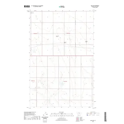
2020 Map of Sage Lake
USGS Topo · Published 2020About this map
Sage Lake and a series of distinct drainage coulees characterize this northern Montana landscape in Hill County. The terrain is marked by a network of seasonal watercourses, most notably Alkali Lakes Coulee and Sage Lake Coulee, which flow through the sectioned plains. This 2020 survey reveals a sparse human footprint typical of the High Plains, where movement is dictated by a few straight-line corridors such as Kremlin High Grade Rd and Rd 285 S. The map detail focuses on the subtle topography of these coulees, including Wild Rose Coulee and Alkali Coulee, illustrating the natural water-retention patterns in this arid region. The township and range lines of the Public Land Survey System define the administrative layout, providing a precise grid for land ownership and resource management research.
Find a feature on this map
11 named features on this map. Tap any name to fly to it.
Don’t see what you’re looking for? This feature index may not catch every label — zoom into the map to look around manually.
Map Details
Editions of this 2020 Sage Lake Map
This is the sole edition of this map. No revisions or reprints were ever made.
Other maps of this area

1904 · Boxelder
USGS Topo · 1:62,500

1906 · Kremlin
USGS Topo · 1:62,500

1906 · Boxelder
USGS Topo · 1:62,500

1919 · Big Sandy
USGS Topo · 1:125,000

1920 · Gildford
USGS Topo · 1:125,000

1943 · Gildford
USGS Topo · 1:125,000

1954 · Shelby
USGS Topo · 1:250,000

1958 · Shelby
USGS Topo · 1:250,000
1969 · Sage Lake
USGS Topo · 1:24,000

1969 · Box Elder NW
USGS Topo · 1:24,000