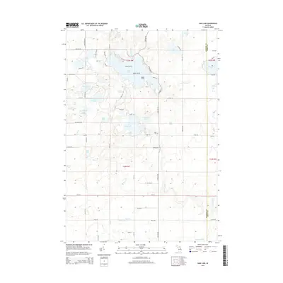
2014 Map of Sage Lake
USGS Topo · Published 2014About this map
Sage Lake serves as the focal point of this northern Michigan landscape, characterized by a complex network of glacial kettle lakes and wetlands on the border of Ogemaw and Iosco counties. The water-rich terrain includes several named islands within the main lake, such as Zerons Island, Middle Island, and Happy Island, alongside smaller nearby bodies like Hidden Lake and Cranberry Lake. Drainage patterns are defined by the Au Gres River and its various tributaries, including Nester Cr and Whitney Cr, which thread through the township.
Find a feature on this map
78 named features on this map. Tap any name to fly to it.
Don’t see what you’re looking for? This feature index may not catch every label — zoom into the map to look around manually.
Map Details
Editions of this 2014 Sage Lake Map
This is the sole edition of this map. No revisions or reprints were ever made.
Other maps of this area

1954 · Traverse City
USGS Topo · 1:250,000

1954 · Tawas City
USGS Topo · 1:250,000

1958 · Traverse City
USGS Topo · 1:250,000

1958 · Tawas City
USGS Topo · 1:250,000

1965 · Selkirk
USGS Topo · 1:24,000

1965 · Rose City
USGS Topo · 1:24,000

1968 · Hale
USGS Topo · 1:24,000

1968 · Prescott
USGS Topo · 1:24,000

1968 · Whittemore
USGS Topo · 1:24,000

1968 · Sage Lake
USGS Topo · 1:24,000