1954 Map of Sage
USGS Topo · Published 1973About this map
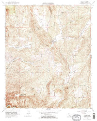
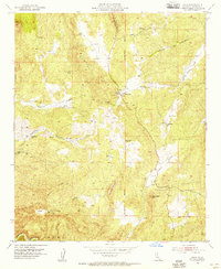
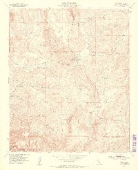
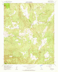
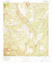
The small settlement of Sage serves as the hub for this mid-century view of the high desert and mountain transition in Riverside County. Located near a Fire Control Station and a set of Graves, the community is positioned at the intersection of rugged upland terrain and seasonal watercourses. The landscape is defined by significant ridges and peaks, including the Magee Hills, Black Hills, and the prominence of Oak Mountain. These elevations frame narrow valleys such as Glenoak Valley and Weber Valley, where the presence of numerous Windmill sites and reservoirs suggests a reliance on groundwater for the local ranching or agricultural operations of the era.
Find a feature on this map
31 named features on this map. Tap any name to fly to it.
Don’t see what you’re looking for? This feature index may not catch every label — zoom into the map to look around manually.
Map Details
Editions of this 1954 Sage Map
5 editions found
Other maps of this area

1901 · Southern California Sheet No. 1
USGS Topo · 1:250,000

1901 · San Jacinto
USGS Topo · 1:125,000

1901 · Elsinore
USGS Topo · 1:125,000

1901 · San Luis Rey
USGS Topo · 1:125,000

1903 · Ramona
USGS Topo · 1:125,000

1904 · Southern California Sheet No. 2
USGS Topo · 1:250,000

1904 · Southern California Sheet No. 1
USGS Topo · 1:250,000

1939 · Palomar Mountain
USGS Topo · 1:62,500

1942 · Temecula
USGS Topo · 1:62,500

1942 · Hemet
USGS Topo · 1:62,500