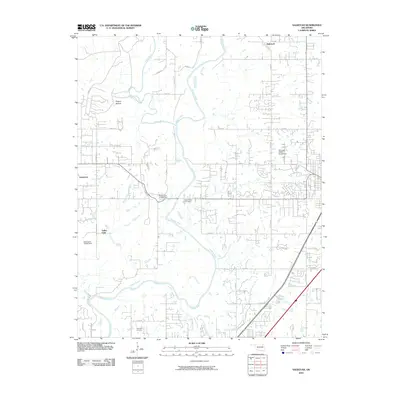
2010 Map of Sageeyah
USGS Topo · Published 2010About this map
The settlement of Sageeyah anchors the northern reaches of this Rogers County landscape, where the winding course of the Verdigris River dominates the terrain. This 2010 survey illustrates the transition of the region north of Owasso, showing the proximity of Limestone and the expansive network of rural roads that serve the local community. The mapping reflects a modern era of development, tracing the intricate path of the river as it meanders through the central and southern portions of the quadrangle, punctuated by numerous small bodies of water and drainage systems that define the hydrology of this Oklahoma prairie land.
Find a feature on this map
2 named features on this map. Tap any name to fly to it.
Don’t see what you’re looking for? This feature index may not catch every label — zoom into the map to look around manually.
Map Details
Editions of this 2010 Sageeyah Map
This is the sole edition of this map. No revisions or reprints were ever made.
Other maps of this area

1901 · Claremore
USGS Topo · 1:125,000

1914 · Claremore
USGS Topo · 1:125,000

1916 · Claremore
USGS Topo · 1:125,000

1954 · Tulsa
USGS Topo · 1:250,000

1955 · Mingo
USGS Topo · 1:24,000

1956 · Collinsville
USGS Topo · 1:24,000

1958 · Tulsa
USGS Topo · 1:250,000

1959 · Collinsville NE
USGS Topo · 1:24,000

1963 · Tulsa
USGS Topo · 1:250,000
1963 · Sageeyah
USGS Topo · 1:24,000