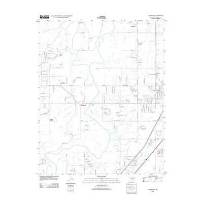
2012 Map of Sageeyah
USGS Topo · Published 2012About this map
The Verdigris River and Caney River converge in this Oklahoma landscape, creating a complex network of waterways and lowlands that includes Boggy Cr and Honey Cr. Modern residential development is evident in the cluster of street names near Limestone and Valley Park, while the campus of Rogers State Univ occupies a prominent position in the eastern portion of the quadrangle. Transportation infrastructure is a defining characteristic, featuring the BNSF Railway corridor and local aviation facilities such as Avian Country Estates Airport and Barcus Field Airport. For those researching local family history, the map identifies several established burial grounds, including Sageeyah Cem, Lone Elm Cem, and Chambers Cem. Small communities like Keetonville and Sageeyah remain central to the region's geography, even as newer subdivisions expand across the terrain of Hickory Hollow.
Find a feature on this map
148 named features on this map. Tap any name to fly to it.
Don’t see what you’re looking for? This feature index may not catch every label — zoom into the map to look around manually.
Map Details
Editions of this 2012 Sageeyah Map
This is the sole edition of this map. No revisions or reprints were ever made.
Other maps of this area

1901 · Claremore
USGS Topo · 1:125,000

1914 · Claremore
USGS Topo · 1:125,000

1916 · Claremore
USGS Topo · 1:125,000

1954 · Tulsa
USGS Topo · 1:250,000

1955 · Mingo
USGS Topo · 1:24,000

1956 · Collinsville
USGS Topo · 1:24,000

1958 · Tulsa
USGS Topo · 1:250,000

1959 · Collinsville NE
USGS Topo · 1:24,000

1963 · Tulsa
USGS Topo · 1:250,000
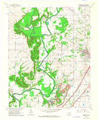
1963 · Sageeyah
USGS Topo · 1:24,000