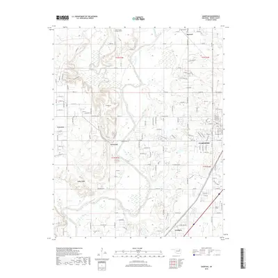
2018 Map of Sageeyah
USGS Topo · Published 2018About this map
The Verdigris River and Caney River converge in this Rogers County landscape, creating a distinct topographical corridor that has shaped local settlement patterns for generations. Small community centers like Keetonville, Limestone, and Sageeyah are situated across the terrain, connected by an extensive grid of section-line roads such as E 445 Rd and E 450 Rd. The eastern edge of the map shows the residential expansion of Claremore, while the southern portion features the community of Verdigris. Genealogy researchers can find several historic burial grounds, including Sageeyah Cem, Lone Elm Cem, and Chambers Cem. The BNSF Railway runs through the eastern corridor, serving as a primary industrial artery alongside modern developments like the Avian Country Estates Airport and Barcus Field.
Find a feature on this map
120 named features on this map. Tap any name to fly to it.
Don’t see what you’re looking for? This feature index may not catch every label — zoom into the map to look around manually.
Map Details
Editions of this 2018 Sageeyah Map
This is the sole edition of this map. No revisions or reprints were ever made.
Other maps of this area

1901 · Claremore
USGS Topo · 1:125,000

1914 · Claremore
USGS Topo · 1:125,000

1916 · Claremore
USGS Topo · 1:125,000

1954 · Tulsa
USGS Topo · 1:250,000

1955 · Mingo
USGS Topo · 1:24,000

1956 · Collinsville
USGS Topo · 1:24,000

1958 · Tulsa
USGS Topo · 1:250,000

1959 · Collinsville NE
USGS Topo · 1:24,000

1963 · Tulsa
USGS Topo · 1:250,000
1963 · Sageeyah
USGS Topo · 1:24,000