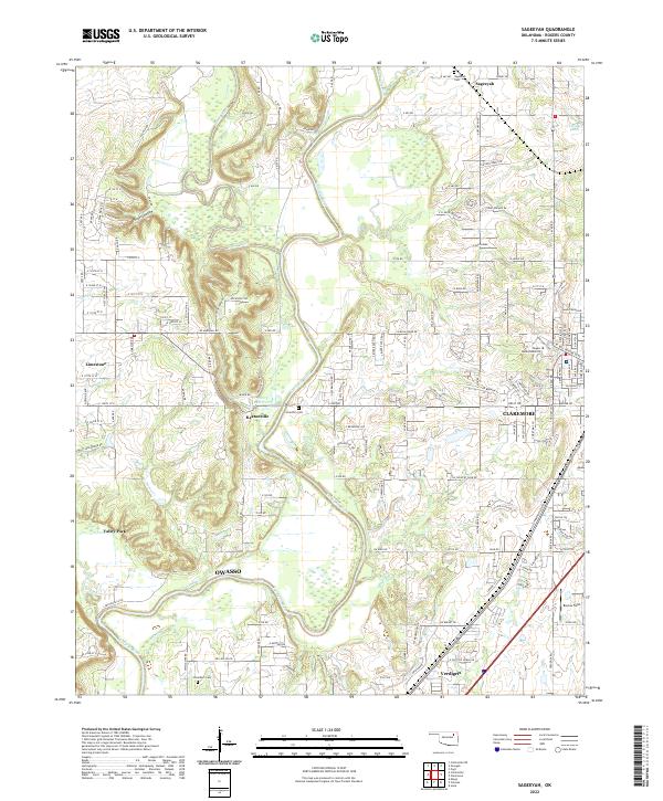
2022 Map of Sageeyah
USGS Topo · Published 2022About this map
The Verdigris River and Caney River converge in this Rogers County landscape, a region defined by its waterway junctions and growing residential corridors. Near the city of Claremore, the campus of Rogers State University stands as a prominent landmark on the eastern edge of the survey. The map records several vital burial grounds for genealogists, including Sageeyah Cem in the north and Chambers Cem near the southern boundary. Small settlements such as Keetonville and Limestone are situated among the river bends and agricultural fields, connected by a dense network of country roads. To the east, Barcus Field and the 31003 Reservoir represent the local topography alongside Hickory Hollow, providing a clear look at the area's physical character at the start of the 2020s.
Find a feature on this map
87 named features on this map. Tap any name to fly to it.
Don’t see what you’re looking for? This feature index may not catch every label — zoom into the map to look around manually.
Map Details
Editions of this 2022 Sageeyah Map
This is the sole edition of this map. No revisions or reprints were ever made.
Other maps of this area

1901 · Claremore
USGS Topo · 1:125,000

1914 · Claremore
USGS Topo · 1:125,000

1916 · Claremore
USGS Topo · 1:125,000

1954 · Tulsa
USGS Topo · 1:250,000

1955 · Mingo
USGS Topo · 1:24,000

1956 · Collinsville
USGS Topo · 1:24,000

1958 · Tulsa
USGS Topo · 1:250,000

1959 · Collinsville NE
USGS Topo · 1:24,000

1963 · Tulsa
USGS Topo · 1:250,000
1963 · Sageeyah
USGS Topo · 1:24,000