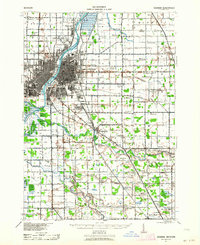
1941 Map of Saginaw
USGS Topo · Published 1964About this map
The Saginaw River valley serves as the industrial and transportation backbone of this region, where the Tittabawassee River, Shiawassee River, Cass River, and Flint River converge near the city of Saginaw. This complex river network supported a dense arrangement of mid-century infrastructure, including the Michigan Central, Pere Marquette, and Grand Trunk railroads that radiate from the city center. The landscape is notably defined by its agrarian and educational history, evidenced by dozens of named schoolhouses such as Canada Street Sch, King Road Sch, and Hess Sch dotting the townships.
Find a feature on this map
76 named features on this map. Tap any name to fly to it.
Don’t see what you’re looking for? This feature index may not catch every label — zoom into the map to look around manually.
Map Details
Editions of this 1941 Saginaw Map
2 editions found
Other maps of this area

1916 · Bay City
USGS Topo · 1:62,500

1917 · Chesaning
USGS Topo · 1:62,500

1917 · St. Charles
USGS Topo · 1:62,500

1919 · Bay City
USGS Topo · 1:62,500

1919 · Saginaw
USGS Topo · 1:62,500

1919 · Burt
USGS Topo · 1:62,500

1920 · Flint
USGS Topo · 1:62,500

1921 · Burt
USGS Topo · 1:62,500

1922 · Flint
USGS Topo · 1:62,500

1941 · Saginaw
USGS Topo · 1:62,500