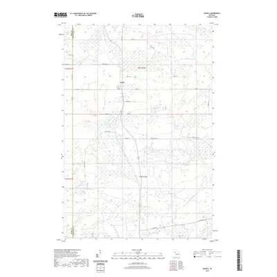
2019 Map of Sagola
USGS Topo · Published 2019About this map
Sagola serves as the primary settlement in this Upper Peninsula landscape, situated near the western edge of Dickinson County along the border with Iron County. The area is defined by a dense network of waterways and wetlands, particularly the convergence of the N Br Sturgeon River, W Br Sturgeon River, and E Br Sturgeon River. These river branches, along with the Ford River in the north, historically supported the region's timber and transport industries. Numerous glacial lakes are scattered throughout the township, including Spirit Lake, Tamarack Lake, and Tobey Lake. Notable land features include the wetland-bordered Robbins Pond and several section-named water bodies. The road network, including Wells Grade Rd and Co Rd 569, follows the low-lying terrain between these extensive river systems.
Find a feature on this map
35 named features on this map. Tap any name to fly to it.
Don’t see what you’re looking for? This feature index may not catch every label — zoom into the map to look around manually.
Map Details
Editions of this 2019 Sagola Map
This is the sole edition of this map. No revisions or reprints were ever made.
Other maps of this area

1899 · Sagola
USGS Topo · 1:62,500

1939 · Iron Mountain
USGS Topo · 1:48,000

1941 · Iron Mountain
USGS Topo · 1:48,000

1947 · Iron Mountain
USGS Topo · 1:48,000

1947 · Kiernan
USGS Topo · 1:24,000

1947 · Lake Mary
USGS Topo · 1:24,000
1949 · Commonwealth
USGS Topo · 1:24,000

1954 · Iron Mountain
USGS Topo · 1:250,000

1954 · Escanaba
USGS Topo · 1:250,000

1955 · Ralph NW
USGS Topo · 1:24,000