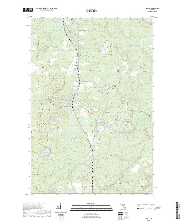
2023 Map of Sagola
USGS Topo · Published 2023About this map
The settlement of Sagola serves as the central hub for this portion of the Upper Peninsula, situated at the junction of key routes through the Dickinson and Iron County borderlands. The landscape is defined by an intricate network of waterways, most notably the winding courses of the North Branch Sturgeon River and the West Branch Sturgeon River. In the northern reaches, the Ford River cuts across the terrain, while the central and southern sections are dotted with numerous named basins including Fox Lake, Bush Lake, and the geographically designated Section Nine Lake and Section Eleven Lake. Local names are preserved through primitive routes and landmarks such as Wells Grade Rd and Gestner Branch, reflecting the region's enduring reliance on the timber and water systems that first drew inhabitants to this part of Michigan.
Find a feature on this map
38 named features on this map. Tap any name to fly to it.
Don’t see what you’re looking for? This feature index may not catch every label — zoom into the map to look around manually.
Map Details
Editions of this 2023 Sagola Map
This is the sole edition of this map. No revisions or reprints were ever made.
Other maps of this area

1899 · Sagola
USGS Topo · 1:62,500

1939 · Iron Mountain
USGS Topo · 1:48,000

1941 · Iron Mountain
USGS Topo · 1:48,000

1947 · Iron Mountain
USGS Topo · 1:48,000

1947 · Kiernan
USGS Topo · 1:24,000

1947 · Lake Mary
USGS Topo · 1:24,000
1949 · Commonwealth
USGS Topo · 1:24,000

1954 · Iron Mountain
USGS Topo · 1:250,000

1954 · Escanaba
USGS Topo · 1:250,000

1955 · Ralph NW
USGS Topo · 1:24,000