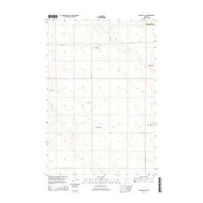
2014 Map of Sahara Hill SE
USGS Topo · Published 2014About this map
Cameron Cr winds through this rural landscape on the border of Musselshell and Golden Valley counties, reflecting a remote section of Montana dedicated primarily to ranching and open land. The drainage of Twin Coulee serves as a prominent landmark in the western portion of the survey, where the terrain is marked by the complex draws and ridges typical of this central Montana region. This 2014 survey captures a network of rural access routes like Homestead Rd and Lewis Rd, which suggest the historic locations of early twentieth-century homesteads. The surveyor's grid is clearly defined, with roads such as E Redhill Rd and Middle Rd following section lines, illustrating how the Public Land Survey System dictated the human geography of these plains. The lack of concentrated settlements highlights the area's continued use as grazing land, where the most significant infrastructure consists of these isolated roads and natural watercourses.
Find a feature on this map
15 named features on this map. Tap any name to fly to it.
Don’t see what you’re looking for? This feature index may not catch every label — zoom into the map to look around manually.
Map Details
Editions of this 2014 Sahara Hill SE Map
This is the sole edition of this map. No revisions or reprints were ever made.
Other maps of this area

1889 · Big Snowy Mountain
USGS Topo · 1:250,000

1893 · Big Snowy Mountain
USGS Topo · 1:250,000

1954 · Roundup
USGS Topo · 1:250,000

1958 · Roundup
USGS Topo · 1:250,000

1979 · Roundup
USGS Topo · 1:100,000

1979 · Lavina NW
USGS Topo · 1:24,000

1986 · Devils Hole Lake
USGS Topo · 1:24,000

1986 · Patterson Canyon
USGS Topo · 1:24,000

1986 · Emory School
USGS Topo · 1:24,000

1986 · Cushman NW
USGS Topo · 1:24,000