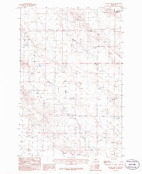
1986 Map of Sahara Hill SE
USGS Topo · Published 1986About this map
The High Plains of central Montana are defined by deep drainages and isolated landmarks in this mid-1980s survey. Cameron Creek flows across the northern sections, while the bifurcated path of Twin Coulee cuts through the center and southern reaches, illustrating the erosional character of the landscape near the Golden Valley and Musselshell county line. The terrain rises to the prominent Sahara Hill, a distinctive natural feature in an otherwise sparsely populated region.
Find a feature on this map
9 named features on this map. Tap any name to fly to it.
Don’t see what you’re looking for? This feature index may not catch every label — zoom into the map to look around manually.
Map Details
Editions of this 1986 Sahara Hill SE Map
This is the sole edition of this map. No revisions or reprints were ever made.
Other maps of this area

1889 · Big Snowy Mountain
USGS Topo · 1:250,000

1893 · Big Snowy Mountain
USGS Topo · 1:250,000

1954 · Roundup
USGS Topo · 1:250,000

1958 · Roundup
USGS Topo · 1:250,000

1979 · Roundup
USGS Topo · 1:100,000

1979 · Lavina NW
USGS Topo · 1:24,000

1986 · Devils Hole Lake
USGS Topo · 1:24,000

1986 · Patterson Canyon
USGS Topo · 1:24,000

1986 · Emory School
USGS Topo · 1:24,000

1986 · Cushman NW
USGS Topo · 1:24,000