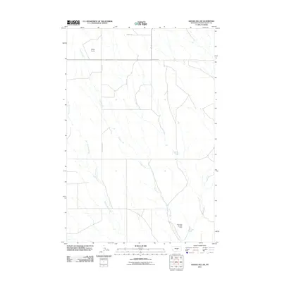
2011 Map of Sahara Hill SW
USGS Topo · Published 2011About this map
Currant Creek and Merrill's Springs Creek define the drainage patterns of this Golden Valley County landscape, cutting through the high plains terrain. The area's agricultural and ranching heritage is evidenced by the systematic grid of rural thoroughfares, including Metzger Rd, Homestead Rd, and West Rothiemay Rd, which segment the territory for access to remote grazing lands. In the northern reaches, the depression of Ashley Coulee provides a distinct geographical landmark, while the southern end of the quadrangle reveals a managed water resource at the Paint Rock Number 1 Dam. This 2011 survey documents a sparsely populated region where survival and industry are dictated by the presence of seasonal water sources and the maintenance of essential access roads.
Find a feature on this map
7 named features on this map. Tap any name to fly to it.
Don’t see what you’re looking for? This feature index may not catch every label — zoom into the map to look around manually.
Map Details
Editions of this 2011 Sahara Hill SW Map
This is the sole edition of this map. No revisions or reprints were ever made.
Other maps of this area

1889 · Big Snowy Mountain
USGS Topo · 1:250,000

1893 · Big Snowy Mountain
USGS Topo · 1:250,000

1954 · Roundup
USGS Topo · 1:250,000

1958 · Roundup
USGS Topo · 1:250,000

1986 · Patterson Canyon
USGS Topo · 1:24,000

1986 · Wallum
USGS Topo · 1:24,000

1986 · Cushman NW
USGS Topo · 1:24,000
1986 · Rothiemay
USGS Topo · 1:24,000
1986 · Cushman NE
USGS Topo · 1:24,000
1986 · Sahara Hill
USGS Topo · 1:24,000