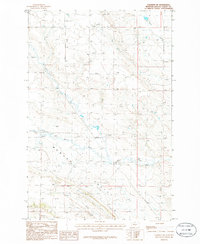
1986 Map of Cushman NE
USGS Topo · Published 1986About this map
Womans Pocket dominates the south-central landscape of this Montana prairie, a distinct topographic depression defined by the intricate drainages that feed into it. The terrain is characterized by a network of seasonal watercourses and springs, indicating a region where water management was essential for local ranching and land use in the mid-1980s. Fivemile Creek cuts across the southern portion of the sheet, while the winding path of Currant Creek and the localized Merrills Springs provide vital orientation points in an otherwise open rangeland. In the northeast, the land slopes toward Twin Coulee, illustrating the subtle yet complex erosion patterns of the Golden Valley County plains during this era of U.S. Geological Survey mapping.
Find a feature on this map
5 named features on this map. Tap any name to fly to it.
Don’t see what you’re looking for? This feature index may not catch every label — zoom into the map to look around manually.
Map Details
Editions of this 1986 Cushman NE Map
This is the sole edition of this map. No revisions or reprints were ever made.
Other maps of this area

1889 · Big Snowy Mountain
USGS Topo · 1:250,000

1893 · Big Snowy Mountain
USGS Topo · 1:250,000

1954 · Roundup
USGS Topo · 1:250,000

1958 · Roundup
USGS Topo · 1:250,000

1979 · Roundup
USGS Topo · 1:100,000

1979 · Lavina NW
USGS Topo · 1:24,000

1979 · Lavina
USGS Topo · 1:24,000
1986 · Ryegate East
USGS Topo · 1:24,000

1986 · Emory School
USGS Topo · 1:24,000

1986 · Cushman NW
USGS Topo · 1:24,000