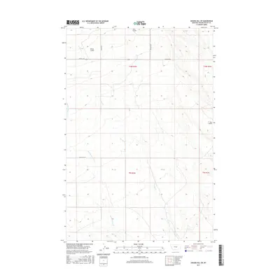
2017 Map of Sahara Hill SW
USGS Topo · Published 2017About this map
Sahara Hill rises above the high plains of Golden Valley County, marking a landscape defined by deep drainages and rural access routes. The area is characterized by significant topographic breaks such as Ashley Coulee and Twin Coulee, which channel seasonal runoff toward the south. Waterways including Currant Cr and Merrills Springs Cr thread through the township blocks, providing vital water sources in this semi-arid region.
Find a feature on this map
13 named features on this map. Tap any name to fly to it.
Don’t see what you’re looking for? This feature index may not catch every label — zoom into the map to look around manually.
Map Details
Editions of this 2017 Sahara Hill SW Map
This is the sole edition of this map. No revisions or reprints were ever made.
Other maps of this area

1889 · Big Snowy Mountain
USGS Topo · 1:250,000

1893 · Big Snowy Mountain
USGS Topo · 1:250,000

1954 · Roundup
USGS Topo · 1:250,000

1958 · Roundup
USGS Topo · 1:250,000

1986 · Patterson Canyon
USGS Topo · 1:24,000

1986 · Wallum
USGS Topo · 1:24,000

1986 · Cushman NW
USGS Topo · 1:24,000
1986 · Rothiemay
USGS Topo · 1:24,000
1986 · Cushman NE
USGS Topo · 1:24,000
1986 · Sahara Hill
USGS Topo · 1:24,000