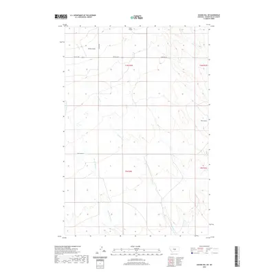
2020 Map of Sahara Hill SW
USGS Topo · Published 2020About this map
Merrills Springs Cr and Currant Cr carve a network of drainage through the high plains of Golden Valley County in this modern topographic survey. The landscape is defined by the sharp incisions of Ashley Coulee and Twin Coulee, which disrupt the otherwise orderly grid of section lines and gravel roads. Public land survey system markers indicate the jurisdictional boundaries of t10n r20e and t9n r20e, illustrating how the township and range system remains the primary framework for land ownership and navigation in this ranching country. Sparse infrastructure connects the few remote dwellings and agricultural operations via a handful of named corridors, including Metzger Rd and Red Hill Rd. These routes track the higher ground between coulees, providing a look at the contemporary spatial organization of Montana's central plains.
Find a feature on this map
12 named features on this map. Tap any name to fly to it.
Don’t see what you’re looking for? This feature index may not catch every label — zoom into the map to look around manually.
Map Details
Editions of this 2020 Sahara Hill SW Map
This is the sole edition of this map. No revisions or reprints were ever made.
Other maps of this area

1889 · Big Snowy Mountain
USGS Topo · 1:250,000

1893 · Big Snowy Mountain
USGS Topo · 1:250,000

1954 · Roundup
USGS Topo · 1:250,000

1958 · Roundup
USGS Topo · 1:250,000

1986 · Patterson Canyon
USGS Topo · 1:24,000

1986 · Wallum
USGS Topo · 1:24,000

1986 · Cushman NW
USGS Topo · 1:24,000
1986 · Rothiemay
USGS Topo · 1:24,000
1986 · Cushman NE
USGS Topo · 1:24,000
1986 · Sahara Hill
USGS Topo · 1:24,000