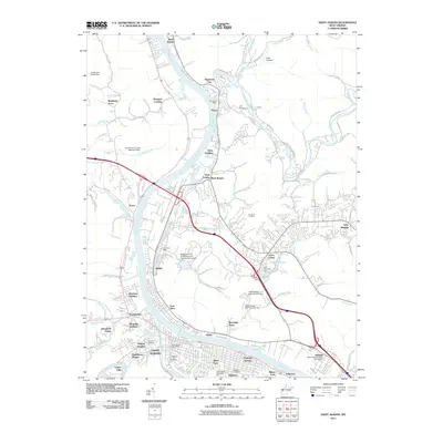
2011 Map of Saint Albans
USGS Topo · Published 2011About this map
The Kanawha River serves as the central artery for this portion of the valley, winding past industrial centers and established residential neighborhoods. This 2011 survey documents the dense corridor between Saint Albans and Nitro, where the river's path is mirrored by a network of suburban developments like Arborland Acres and Tyler Heights. The presence of several dams, including Poffenbarger Dam Number One and Lake Chaweva Dam, points to a highly managed water system supporting both recreation and infrastructure.
Find a feature on this map
97 named features on this map. Tap any name to fly to it.
Don’t see what you’re looking for? This feature index may not catch every label — zoom into the map to look around manually.
Map Details
Editions of this 2011 Saint Albans Map
This is the sole edition of this map. No revisions or reprints were ever made.
Other maps of this area

1899 · Charleston
USGS Topo · 1:125,000

1906 · Kenna
USGS Topo · 1:62,500

1906 · Winfield
USGS Topo · 1:62,500

1907 · Kenna
USGS Topo · 1:62,500

1908 · Winfield
USGS Topo · 1:62,500

1909 · Charleston
USGS Topo · 1:62,500

1909 · Saint Albans
USGS Topo · 1:62,500

1931 · Saint Albans
USGS Topo · 1:62,500

1931 · Charleston
USGS Topo · 1:62,500

1933 · Saint Albans
USGS Topo · 1:62,500