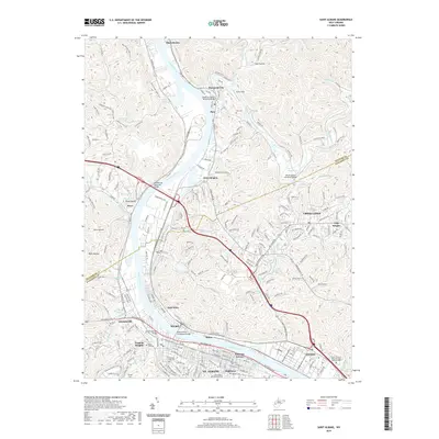
2019 Map of Saint Albans
USGS Topo · Published 2019About this map
The Kanawha River serves as the central artery for this portion of West Virginia, where industrial heritage meets suburban expansion along the waterway and its tributaries. The city of Nitro and neighboring St. Albans dominate the southern landscape, while the Mary Draper Ingles Trail traces a historic path through the hills to the north. Settlement patterns here are defined by the convergence of the Coal River and the Kanawha, with neighborhoods like Parkway Terrace and Virginia Heights established on the level ground near the banks. Further north, the topography becomes more complex, marked by steep hollows like Coal Hollow and small creek settlements such as Poca and Black Betsey. This area preserves several significant memorials, including the Donel C Kinnard Memorial State Veterans Cem and Cunningham Memorial Park, reflecting the region's deep community ties and commemorative landscape.
Find a feature on this map
233 named features on this map. Tap any name to fly to it.
Don’t see what you’re looking for? This feature index may not catch every label — zoom into the map to look around manually.
Map Details
Editions of this 2019 Saint Albans Map
This is the sole edition of this map. No revisions or reprints were ever made.
Other maps of this area

1899 · Charleston
USGS Topo · 1:125,000

1906 · Kenna
USGS Topo · 1:62,500

1906 · Winfield
USGS Topo · 1:62,500

1907 · Kenna
USGS Topo · 1:62,500

1908 · Winfield
USGS Topo · 1:62,500

1909 · Charleston
USGS Topo · 1:62,500

1909 · Saint Albans
USGS Topo · 1:62,500

1931 · Saint Albans
USGS Topo · 1:62,500

1931 · Charleston
USGS Topo · 1:62,500

1933 · Saint Albans
USGS Topo · 1:62,500