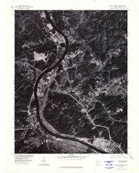
1976 Map of Saint Albans
USGS Topo · Published 1980About this map
The Kanawha River serves as the dominant industrial and geographical corridor in this orthophotograph, a specialized map type that combines the visual detail of aerial photography with the precision of topographic surveying. Captured in the mid-1970s, the imagery reveals the dense development of Saint Albans and the sprawling industrial footprints in Nitro and Institute. These settlements developed along the valley floor, constrained by the steep, wooded hillsides that rise sharply from the riverbanks. To the north, the winding course of the Pocatalico River meets the Kanawha near the community of Poca. Smaller settlements like Black Betsey and Flatwoods are visible on the periphery, illustrating the transition from heavy industry to more rural landscapes during this era. The level of detail allows for a direct observation of land use, from residential neighborhoods to large-scale chemical and manufacturing facilities.
Find a feature on this map
8 named features on this map. Tap any name to fly to it.
Don’t see what you’re looking for? This feature index may not catch every label — zoom into the map to look around manually.
Map Details
Editions of this 1976 Saint Albans Map
This is the sole edition of this map. No revisions or reprints were ever made.
Other maps of this area

1899 · Charleston
USGS Topo · 1:125,000

1906 · Kenna
USGS Topo · 1:62,500

1906 · Winfield
USGS Topo · 1:62,500

1907 · Kenna
USGS Topo · 1:62,500

1908 · Winfield
USGS Topo · 1:62,500

1909 · Charleston
USGS Topo · 1:62,500

1909 · Saint Albans
USGS Topo · 1:62,500

1931 · Saint Albans
USGS Topo · 1:62,500

1931 · Charleston
USGS Topo · 1:62,500

1933 · Saint Albans
USGS Topo · 1:62,500