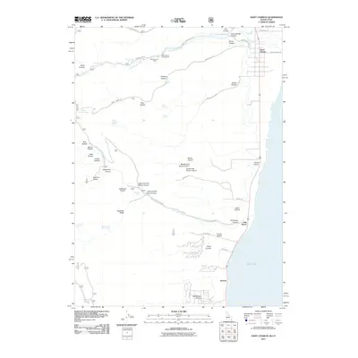
2011 Map of Saint Charles
USGS Topo · Published 2011About this map
Bear Lake dominates the eastern shoreline of this Idaho-Utah border region, where the settlements of Saint Charles and Fish Haven sit at the foot of the rising Wasatch Range. The 2011 survey reveals a landscape defined by deep canyons and mountain springs that feed into the valley floor, including Saint Charles Creek and Fish Haven Creek. Local history is marked by the presence of the Blackstone Mine north of Minnetonka Cave Rd, indicating a legacy of resource extraction in the hills above the lake. Further south, the community of Glencoe is situated near Williamson Hollow, while the far southwestern corner of the quadrangle touches Swan Lake. The road network, including Turnpike Rd and Harrup Rd, illustrates how transportation follows the natural contours of the canyons and the flat lakeside terrace.
Find a feature on this map
59 named features on this map. Tap any name to fly to it.
Don’t see what you’re looking for? This feature index may not catch every label — zoom into the map to look around manually.
Map Details
Editions of this 2011 Saint Charles Map
This is the sole edition of this map. No revisions or reprints were ever made.
Other maps of this area

1909 · Montpelier
USGS Topo · 1:125,000

1911 · Montpelier
USGS Topo · 1:125,000

1912 · Randolph
USGS Topo · 1:125,000

1914 · Logan
USGS Topo · 1:125,000

1915 · Preston
USGS Topo · 1:96,000

1916 · Logan
USGS Topo · 1:125,000

1918 · Preston
USGS Topo · 1:125,000

1954 · Ogden
USGS Topo · 1:250,000

1955 · Preston
USGS Topo · 1:250,000

1958 · Ogden
USGS Topo · 1:250,000