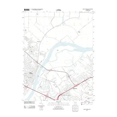
2012 Map of Saint Charles
USGS Topo · Published 2012About this map
Saint Charles serves as the focal point of this Missouri landscape, situated along the western banks of the Missouri River. The area illustrates a complex network of transportation and university life, with Lindenwood University established near the city center. Across the river, the developed corridors of Earth City and Bridgeton meet the expansive grounds of the Lambert-Saint Louis International Airport. This 2012 survey captures the transition from urban density to the floodplain topography of Bryan Island and Les Mamelles. Historical continuity is evident in the numerous burial grounds documented, including Emmaus Cemetery, Borromeo Cemetery, and Saint Peters Cemetery. The Wabash Bridge and Electric Bridge provide critical crossings, linking the industrial parks of the eastern shore with the residential and academic heart of the county seat.
Find a feature on this map
99 named features on this map. Tap any name to fly to it.
Don’t see what you’re looking for? This feature index may not catch every label — zoom into the map to look around manually.
Map Details
Editions of this 2012 Saint Charles Map
This is the sole edition of this map. No revisions or reprints were ever made.
Other maps of this area

1903 · O'Fallon
USGS Topo · 1:125,000

1924 · Robertson
USGS Topo · 1:24,000

1927 · St. Charles
USGS Topo · 1:62,500

1931 · Brussels
USGS Topo · 1:62,500

1932 · Manchester NE
USGS Topo · 1:24,000

1933 · Creve Coeur
USGS Topo · 1:24,000

1933 · Clayton
USGS Topo · 1:24,000

1933 · Saint Charles
USGS Topo · 1:62,500

1935 · Florissant
USGS Topo · 1:24,000

1939 · Brussels
USGS Topo · 1:62,500