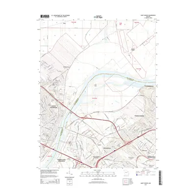
2015 Map of Saint Charles
USGS Topo · Published 2015About this map
The Missouri River forms a wide, winding boundary between Saint Charles and St. Louis County, serving as the central geographic feature of this mid-2010s landscape. On the western bank, the historic street grid of Saint Charles is anchored by Lindenwood College and local landmarks like Borromeo Church and Emmaus Cemetery. The floodplains across the river show a distinct transition from the industrial development at Earth City and Bridgeton to the more open agricultural and riparian areas near Bryan Island and Marais Croche.
Find a feature on this map
155 named features on this map. Tap any name to fly to it.
Don’t see what you’re looking for? This feature index may not catch every label — zoom into the map to look around manually.
Map Details
Editions of this 2015 Saint Charles Map
This is the sole edition of this map. No revisions or reprints were ever made.
Other maps of this area

1903 · O'Fallon
USGS Topo · 1:125,000

1924 · Robertson
USGS Topo · 1:24,000

1927 · St. Charles
USGS Topo · 1:62,500

1931 · Brussels
USGS Topo · 1:62,500

1932 · Manchester NE
USGS Topo · 1:24,000

1933 · Creve Coeur
USGS Topo · 1:24,000

1933 · Clayton
USGS Topo · 1:24,000

1933 · Saint Charles
USGS Topo · 1:62,500

1935 · Florissant
USGS Topo · 1:24,000

1939 · Brussels
USGS Topo · 1:62,500