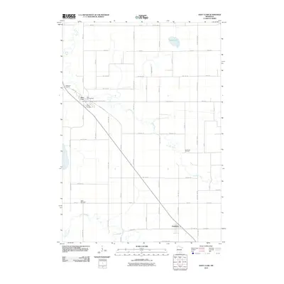
2010 Map of Saint Clair
USGS Topo · Published 2010About this map
Saint Clair serves as a primary settlement hub along the winding course of the Le Sueur River in this rural portion of Blue Earth County. The landscape is characterized by a dense network of township and county roads that support the region's agricultural economy, connecting the northern village to the smaller community of Pemberton in the south. Local history and genealogy are well-represented by a high concentration of burial grounds, including the McPherson Cemetery, Immaculate Conception Cemetery, and Saint Johns Cemetery, which cluster around the northern settlements. To the east, Indian Lake stands as a notable water feature, while the southern section is drained by the Little Cobb River. The presence of the Saint Clair Post Office underscores the town's role as a local center for commerce and community services.
Find a feature on this map
61 named features on this map. Tap any name to fly to it.
Don’t see what you’re looking for? This feature index may not catch every label — zoom into the map to look around manually.
Map Details
Editions of this 2010 Saint Clair Map
This is the sole edition of this map. No revisions or reprints were ever made.
Other maps of this area

1950 · Mankato East
USGS Topo · 1:62,500

1951 · Mankato East
USGS Topo · 1:62,500

1953 · Saint Paul
USGS Topo · 1:250,000

1954 · Mason City
USGS Topo · 1:250,000

1957 · Mason City
USGS Topo · 1:250,000

1958 · Mason City
USGS Topo · 1:250,000

1959 · Saint Paul
USGS Topo · 1:250,000

1966 · Janesville
USGS Topo · 1:24,000

1966 · Elysian
USGS Topo · 1:24,000

1967 · Waldorf
USGS Topo · 1:24,000