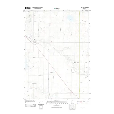
2013 Map of Saint Clair
USGS Topo · Published 2013About this map
The Le Sueur River carves a winding path across this section of south-central Minnesota, defining the agricultural landscape between the small communities of Saint Clair and Pemberton. The map reveals a high concentration of burial sites that trace the area's early settlement history, including McPherson Cem, Immaculate Conception Cem, and Saint Johns Cem near the northwestern corner, and Medo-McPherson Cem further south.
Find a feature on this map
58 named features on this map. Tap any name to fly to it.
Don’t see what you’re looking for? This feature index may not catch every label — zoom into the map to look around manually.
Map Details
Editions of this 2013 Saint Clair Map
This is the sole edition of this map. No revisions or reprints were ever made.
Other maps of this area

1950 · Mankato East
USGS Topo · 1:62,500

1951 · Mankato East
USGS Topo · 1:62,500

1953 · Saint Paul
USGS Topo · 1:250,000

1954 · Mason City
USGS Topo · 1:250,000

1957 · Mason City
USGS Topo · 1:250,000

1958 · Mason City
USGS Topo · 1:250,000

1959 · Saint Paul
USGS Topo · 1:250,000

1966 · Janesville
USGS Topo · 1:24,000

1966 · Elysian
USGS Topo · 1:24,000

1967 · Waldorf
USGS Topo · 1:24,000